Quick Info
Satellite
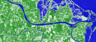
Landsat
Category
Water
Min Value
-1.0
Max Value
1.0
Colormap
BrBG
Bands Used
SR_B3
SR_B5
Satellite Details
Description
NDWI for Landsat delineates open water bodies using green and NIR bands. Positive values indicate water surfaces. Landsat's historical archive enables long-term monitoring of lake level changes, reservoir storage, wetland dynamics, and the impact of climate change on surface water extent.