Quick Info
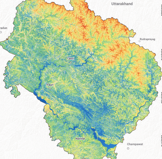
Satellite
Sentinel-2
Category
Water
Min Value
-1.0
Max Value
1.0
Colormap
Blues
Bands Used
nir
swir16
Satellite Details
Description
NDMI measures vegetation water content using NIR and SWIR bands. Higher values indicate greater moisture content in vegetation canopy. It is used for drought monitoring, irrigation management, wildfire risk assessment, and detecting water stress in crops and forests.